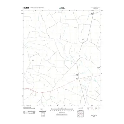
2010 Map of Merry Hill
USGS Topo · Published 2010About this map
Merry Hill and the surrounding Bertie County countryside are defined by a network of expansive wetlands and small farming communities. This landscape is characterized by the intricate drainage systems of Cricket Swamp, Eastmost Swamp, and Flat Swamp Creek, which dictate the placement of local roads and historic properties. Small settlements like Ashland and Taylors Store serve as local landmarks, connected by thoroughfares such as Taylors Store Rd and Old Merry Hill Rd.
Find a feature on this map
43 named features on this map. Tap any name to fly to it.
Don’t see what you’re looking for? This feature index may not catch every label — zoom into the map to look around manually.
Map Details
Editions of this 2010 Merry Hill Map
This is the sole edition of this map. No revisions or reprints were ever made.
Other maps of this area

1904 · Edenton
USGS Topo · 1:62,500

1942 · Edenton
USGS Topo · 1:62,500

1943 · Plymouth
USGS Topo · 1:125,000

1943 · Edenton
USGS Topo · 1:62,500

1953 · Norfolk
USGS Topo · 1:250,000

1953 · Rocky Mount
USGS Topo · 1:250,000

1954 · Rocky Mount
USGS Topo · 1:250,000

1954 · Westover
USGS Topo · 1:24,000

1978 · Windsor South
USGS Topo · 1:24,000
1979 · Woodard
USGS Topo · 1:24,000