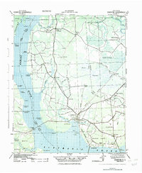
1942 Map of Edenton
USGS Topo · Published 1942About this map
Edenton serves as the focal point for this wartime coastal survey, situated where the Chowan River meets the Albemarle Sound. In the early 1940s, the landscape shows a blend of established river commerce and new military activity, most notably the U S Marine Corps Air Station established along the southern shoreline near St. Johns. Numerous landings and wharves, such as Harris Landing and Hermitage Wharf, dot the riverbank, indicating the lingering importance of water-based transport alongside the Norfolk Southern RR. Inland, the terrain is characterized by intricate drainage systems like Bear Swamp and rural hubs such as Meege Crossroads and Valhalla. The presence of the U S Fish Hatchery and numerous mill ponds, including Dillard Mill Pond, highlights a local economy deeply tied to the region's abundant water resources during the mobilization of the Second World War.
Find a feature on this map
77 named features on this map. Tap any name to fly to it.
Don’t see what you’re looking for? This feature index may not catch every label — zoom into the map to look around manually.
Map Details
Editions of this 1942 Edenton Map
This is the sole edition of this map. No revisions or reprints were ever made.
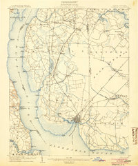
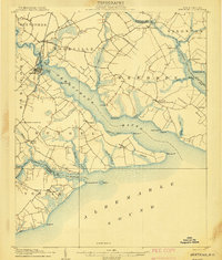
Other maps of this area
1904 · Edenton
USGS Topo · 1:62,500
1906 · Hertford
USGS Topo · 1:62,500

1906 · Beckford
USGS Topo · 1:48,000

1907 · Beckford
USGS Topo · 1:62,500

1908 · Winton
USGS Topo · 1:62,500

1940 · Hertford
USGS Topo · 1:62,500

1940 · Beckford
USGS Topo · 1:62,500

1940 · South Mills
USGS Topo · 1:62,500

1943 · Columbia
USGS Topo · 1:125,000

1943 · Plymouth
USGS Topo · 1:125,000