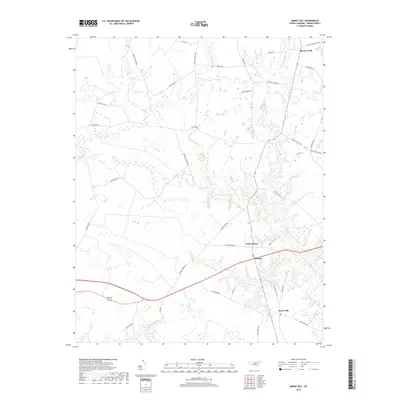
2019 Map of Merry Hill
USGS Topo · Published 2019About this map
Merry Hill and the small crossroads of Taylors Store anchor this Bertie County landscape, where the terrain is defined by an intricate network of wetlands and tributaries. The geography is dominated by significant drainages such as Flat Swamp, Cricket Swamp, and Eastmost Swamp, which feed into Salmon Creek as it moves toward the coast. This map reveals a rural economy organized around these water systems, with numerous family-named roads like Browns School Rd, Capehart Church Rd, and Ashland Church Rd suggesting the locations of historical community centers and places of worship. In the southern portion of the quadrangle, Midway sits along the primary highway corridor, while the northern reaches transition toward the settlement of Mount Gould. The naming of minor features like Landing Place Cr and Dunmore Br provides specific points of interest for those studying the localized hydrologic and cultural history of the Chowan River interior.
Find a feature on this map
42 named features on this map. Tap any name to fly to it.
Don’t see what you’re looking for? This feature index may not catch every label — zoom into the map to look around manually.
Map Details
Editions of this 2019 Merry Hill Map
This is the sole edition of this map. No revisions or reprints were ever made.
Other maps of this area

1904 · Edenton
USGS Topo · 1:62,500

1942 · Edenton
USGS Topo · 1:62,500

1943 · Plymouth
USGS Topo · 1:125,000

1943 · Edenton
USGS Topo · 1:62,500

1953 · Norfolk
USGS Topo · 1:250,000

1953 · Rocky Mount
USGS Topo · 1:250,000

1954 · Rocky Mount
USGS Topo · 1:250,000

1954 · Westover
USGS Topo · 1:24,000

1978 · Windsor South
USGS Topo · 1:24,000
1979 · Woodard
USGS Topo · 1:24,000