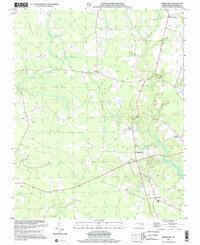
2000 Map of Merry Hill
USGS Topo · Published 2002About this map
Merry Hill and the surrounding rural landscape of Bertie County are defined by a complex network of wetlands and low-lying coastal plains. This area, as documented at the start of the 21st century, shows a community structured around historical crossroads and small settlements like Ashland, Midway, and Gregory Crossroads. The presence of Lawrence Academy and several churches, such as Capeharts Ch, anchors the local social geography, while dozens of unnamed cemeteries suggest a long history of family homesteads scattered throughout the woods.
Find a feature on this map
19 named features on this map. Tap any name to fly to it.
Don’t see what you’re looking for? This feature index may not catch every label — zoom into the map to look around manually.
Map Details
Editions of this 2000 Merry Hill Map
This is the sole edition of this map. No revisions or reprints were ever made.
Other maps of this area

1904 · Edenton
USGS Topo · 1:62,500

1942 · Edenton
USGS Topo · 1:62,500

1943 · Plymouth
USGS Topo · 1:125,000

1943 · Edenton
USGS Topo · 1:62,500

1953 · Norfolk
USGS Topo · 1:250,000

1953 · Rocky Mount
USGS Topo · 1:250,000

1954 · Rocky Mount
USGS Topo · 1:250,000

1954 · Westover
USGS Topo · 1:24,000

1978 · Windsor South
USGS Topo · 1:24,000
1979 · Woodard
USGS Topo · 1:24,000