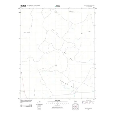
2010 Map of Mesa Chupinas
USGS Topo · Published 2010About this map
Mesa Chupinas and the surrounding high desert plateau define this section of San Miguel County, where ranching infrastructure and intermittent watercourses shape the human geography. The map reveals a land organized by elevation, with distinct landforms such as West Mesa, East Mesa, and South Mesa separated by the winding paths of Aguilar Creek and Spring Creek. Human presence is concentrated at small outposts like Culbertson and Chupinas Camp, suggesting the area's continued use for livestock and seasonal grazing.
Find a feature on this map
14 named features on this map. Tap any name to fly to it.
Don’t see what you’re looking for? This feature index may not catch every label — zoom into the map to look around manually.
Map Details
Editions of this 2010 Mesa Chupinas Map
This is the sole edition of this map. No revisions or reprints were ever made.
Other maps of this area

1890 · Bernal
USGS Topo · 1:125,000

1891 · Bernal
USGS Topo · 1:125,000

1892 · Corazon
USGS Topo · 1:125,000

1894 · Corazon
USGS Topo · 1:125,000

1894 · Bernal
USGS Topo · 1:125,000

1954 · Santa Fe
USGS Topo · 1:250,000

1958 · Santa Fe
USGS Topo · 1:250,000

1960 · Apache Springs
USGS Topo · 1:62,500

1963 · Pedro Miguel Peak
USGS Topo · 1:24,000
1963 · Chaperito
USGS Topo · 1:24,000