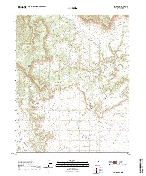
2023 Map of Mesa Chupinas
USGS Topo · Published 2023About this map
Mesa Chupinas and the surrounding high desert terrain define this corner of San Miguel County, where deep canyons and flat-topped mesas create a complex drainage network. The landscape is marked by long-established pastoral sites such as Lemita Ranch and Rael Ranch, connected by rugged tracks like Park Springs Rd. These ranching outposts are positioned to take advantage of reliable water sources in an otherwise arid environment, drawing from named points like Almito Springs, Rincon Spring, and Deer Spring.
Find a feature on this map
19 named features on this map. Tap any name to fly to it.
Don’t see what you’re looking for? This feature index may not catch every label — zoom into the map to look around manually.
Map Details
Editions of this 2023 Mesa Chupinas Map
This is the sole edition of this map. No revisions or reprints were ever made.
Other maps of this area

1890 · Bernal
USGS Topo · 1:125,000

1891 · Bernal
USGS Topo · 1:125,000

1892 · Corazon
USGS Topo · 1:125,000

1894 · Corazon
USGS Topo · 1:125,000

1894 · Bernal
USGS Topo · 1:125,000

1954 · Santa Fe
USGS Topo · 1:250,000

1958 · Santa Fe
USGS Topo · 1:250,000

1960 · Apache Springs
USGS Topo · 1:62,500

1963 · Pedro Miguel Peak
USGS Topo · 1:24,000
1963 · Chaperito
USGS Topo · 1:24,000