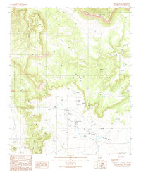
1989 Map of Mesa Chupinas
USGS Topo · Published 1989About this map
Anton Chico anchors the southwestern corner of this San Miguel County landscape, where the high desert terrain is defined by a series of prominent mesas and seasonal water sources. The area is dominated by the expansive Apache Mesa and South Mesa, carved by drainages such as Aguilar Creek and Agua Media Creek. A complex system of human intervention in the arid environment is evident through dozens of mapped Check Dams situated along the many small canyons and creeks. These features, along with names like Rincon Pasture, reflect a long-standing ranching economy dependent on scattered water points. Local history and genealogy interest is concentrated in the numerous named water sources that likely served as essential landmarks for settlers and travelers, including Alamito Springs, Chupinas Spring, and Culverdes Spring. The presence of a Pack Trail winding through the northern canyons further illustrates the historical movement across this varied topography.
Find a feature on this map
25 named features on this map. Tap any name to fly to it.
Don’t see what you’re looking for? This feature index may not catch every label — zoom into the map to look around manually.
Map Details
Editions of this 1989 Mesa Chupinas Map
This is the sole edition of this map. No revisions or reprints were ever made.
Other maps of this area

1890 · Bernal
USGS Topo · 1:125,000

1891 · Bernal
USGS Topo · 1:125,000

1892 · Corazon
USGS Topo · 1:125,000

1894 · Corazon
USGS Topo · 1:125,000

1894 · Bernal
USGS Topo · 1:125,000

1954 · Santa Fe
USGS Topo · 1:250,000

1958 · Santa Fe
USGS Topo · 1:250,000

1960 · Apache Springs
USGS Topo · 1:62,500

1963 · Pedro Miguel Peak
USGS Topo · 1:24,000
1963 · Chaperito
USGS Topo · 1:24,000