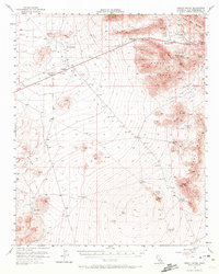
1955 Map of Mescal Range
USGS Topo · Published 1972About this map
Mountain Pass serves as a focal point for mining activity in the northeastern corner of the Mojave Desert during the mid-1950s. The landscape is defined by extensive mineral extraction, evidenced by the Sulphide Queen Mine, Mohawk Mine, and the Birthday Mine clustered near the Mohawk Hill and Clark Mtn Range. These workings highlight the region's industrial importance, while the isolated Cemetery near Valley Wells points to the human toll and longevity of these remote desert communities.
Find a feature on this map
45 named features on this map. Tap any name to fly to it.
Don’t see what you’re looking for? This feature index may not catch every label — zoom into the map to look around manually.
Map Details
Editions of this 1955 Mescal Range Map
3 editions found
Other maps of this area

1910 · Ivanpah
USGS Topo · 1:250,000

1912 · Ivanpah
USGS Topo · 1:250,000

1942 · Ivanpah
USGS Topo · 1:250,000

1947 · Kingman
USGS Topo · 1:250,000

1948 · Kingman
USGS Topo · 1:250,000

1954 · Kingman
USGS Topo · 1:250,000

1955 · Kingman
USGS Topo · 1:250,000

1955 · Kingston Peak
USGS Topo · 1:62,500

1955 · Mescal Range
USGS Topo · 1:62,500

1955 · Roach Lake
USGS Topo · 1:62,500