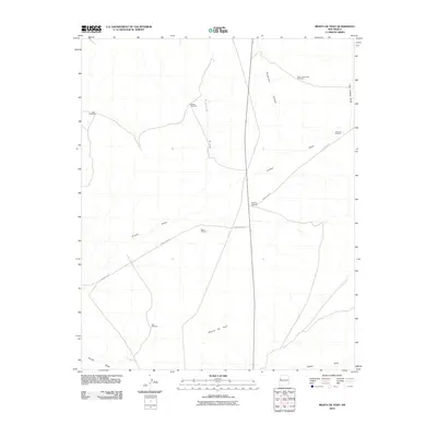
2010 Map of Mesita De Yeso
USGS Topo · Published 2010About this map
Mesita De Yeso rises above a landscape defined by an essential reliance on groundwater in this high desert region of Cibola County. The distribution of family and place-named water infrastructure, such as Pine Windmill, Trujillo Windmill, and High Lonesome Windmill, indicates a long-standing ranching economy where these points served as vital hubs for livestock and survival. The drainage network is clearly etched across the terrain, with Trujillo Draw, Guillermo Canyon, and Pinitos Draw carving paths through the arid soil. Navigation through the area relies on a sparse network of unpaved routes, including County Rd-33 and County Rd-32, which connect the isolated outposts of East Joe Windmill and Red Windmill. This map documents a quiet, working landscape where the names of local draws and canyons provide the primary geographic orientation for those traversing the high plateau.
Find a feature on this map
15 named features on this map. Tap any name to fly to it.
Don’t see what you’re looking for? This feature index may not catch every label — zoom into the map to look around manually.
Map Details
Editions of this 2010 Mesita De Yeso Map
This is the sole edition of this map. No revisions or reprints were ever made.
Other maps of this area

1954 · Saint Johns
USGS Topo · 1:250,000

1957 · Saint Johns
USGS Topo · 1:250,000

1958 · Saint Johns
USGS Topo · 1:250,000

1962 · Saint Johns
USGS Topo · 1:250,000
1972 · Upper Galestina Canyon
USGS Topo · 1:24,000
1972 · Plumasano Basin
USGS Topo · 1:24,000

1972 · Fence Lake
USGS Topo · 1:24,000
1972 · The Dyke
USGS Topo · 1:24,000
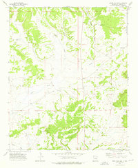
1972 · Mesita De Yeso
USGS Topo · 1:24,000
1972 · Atarque Lake
USGS Topo · 1:24,000