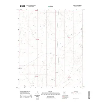
2020 Map of Mesita De Yeso
USGS Topo · Published 2020About this map
Mesita De Yeso rises above a landscape defined by an intricate network of drainage systems in this modern topographic study of Cibola County. The area is characterized by significant natural features such as Guillermo Canyon and the expansive Cañon Ancho, which carve through the high-elevation terrain. This survey reflects a sparsely populated region where navigation is primarily facilitated by rural routes like Co RD 33 and Co RD 32, cutting through the public land survey grid. Water management and natural flow are central themes of the landscape, marked by named ephemeral washes including Trujillo Draw, Ojo Hallado Draw, and Terrero Draw. The map provides a precise look at the township and range boundaries that organize this section of New Mexico, from T8N R18W down to T6N R17W.
Find a feature on this map
15 named features on this map. Tap any name to fly to it.
Don’t see what you’re looking for? This feature index may not catch every label — zoom into the map to look around manually.
Map Details
Editions of this 2020 Mesita De Yeso Map
This is the sole edition of this map. No revisions or reprints were ever made.
Other maps of this area

1954 · Saint Johns
USGS Topo · 1:250,000

1957 · Saint Johns
USGS Topo · 1:250,000

1958 · Saint Johns
USGS Topo · 1:250,000

1962 · Saint Johns
USGS Topo · 1:250,000
1972 · Upper Galestina Canyon
USGS Topo · 1:24,000
1972 · Plumasano Basin
USGS Topo · 1:24,000

1972 · Fence Lake
USGS Topo · 1:24,000
1972 · The Dyke
USGS Topo · 1:24,000
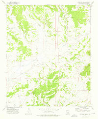
1972 · Mesita De Yeso
USGS Topo · 1:24,000
1972 · Atarque Lake
USGS Topo · 1:24,000