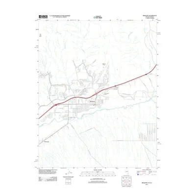
2012 Map of Mesquite
USGS Topo · Published 2012About this map
The Virgin River serves as the central artery for this desert landscape, where the communities of Mesquite and Bunkerville are defined by their proximity to the river’s precious water and the seasonal drainage paths that intersect the valley. The map reveals a transition from traditional agricultural patterns to modern residential expansion, with developments like Redd Hills Pkwy and Falcon Ridge Pkwy pushing into the arid terrain. Aviation infrastructure is surprisingly prominent for a town of this size, featuring both the Mesquite Airport and the Bronze Boot Airport. The surrounding topography is marked by significant natural barriers including Flat Top Mesa and a network of dry washes such as Abbott Wash, Pulsipher Wash, and Sand Hollow Wash, which dictate the local road network and the limits of the settled areas.
Find a feature on this map
54 named features on this map. Tap any name to fly to it.
Don’t see what you’re looking for? This feature index may not catch every label — zoom into the map to look around manually.
Map Details
Editions of this 2012 Mesquite Map
This is the sole edition of this map. No revisions or reprints were ever made.
Other maps of this area

1886 · Saint Thomas
USGS Topo · 1:250,000

1886 · Mt. Trumbull
USGS Topo · 1:250,000

1892 · Mt. Trumbull
USGS Topo · 1:250,000

1893 · Saint Thomas
USGS Topo · 1:250,000

1953 · Grand Canyon
USGS Topo · 1:250,000

1954 · Las Vegas
USGS Topo · 1:250,000

1954 · Littlefield
USGS Topo · 1:62,500

1954 · Cane Springs
USGS Topo · 1:62,500

1957 · Las Vegas
USGS Topo · 1:250,000

1957 · Grand Canyon
USGS Topo · 1:250,000