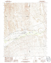
1985 Map of Mesquite
USGS Topo · Published 1985About this map
Virgin Valley serves as the focal point for agricultural and town development in this 1980s-era study of the tri-state border region. The landscape is defined by the vital waters of the Virgin River, which supports the adjacent settlements of Mesquite and Bunkerville. Irrigation is critical to the local economy, evidenced by the prominent Mesquite Flume Ditch and Bunkerville Ditch that skirt the valley floor.
Find a feature on this map
22 named features on this map. Tap any name to fly to it.
Don’t see what you’re looking for? This feature index may not catch every label — zoom into the map to look around manually.
Map Details
Editions of this 1985 Mesquite Map
This is the sole edition of this map. No revisions or reprints were ever made.
Other maps of this area

1886 · Saint Thomas
USGS Topo · 1:250,000

1886 · Mt. Trumbull
USGS Topo · 1:250,000

1892 · Mt. Trumbull
USGS Topo · 1:250,000

1893 · Saint Thomas
USGS Topo · 1:250,000

1953 · Grand Canyon
USGS Topo · 1:250,000

1954 · Las Vegas
USGS Topo · 1:250,000

1954 · Littlefield
USGS Topo · 1:62,500

1954 · Cane Springs
USGS Topo · 1:62,500

1957 · Las Vegas
USGS Topo · 1:250,000

1957 · Grand Canyon
USGS Topo · 1:250,000