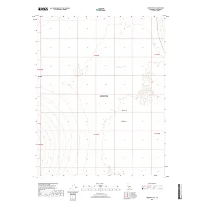
2018 Map of Mesquite Flat
USGS Topo · Published 2018About this map
Death Valley National Park encompasses this arid landscape, where the northern reaches of the Mojave Desert meet the expansive floor of Death Valley. The map illustrates a transition between geological elevations, from the broad, open expanse of Mesquite Flat to the distinct mineral deposits of the Niter Beds. Such features reflect the complex evaporative history of the basin. Reliable water sources are rare in this environment, making the location of Triangle Spring a critical landmark for both wildlife and travelers. This 2018 survey provides a modern record of these natural features within the protected boundaries of Inyo County, showing the intersection of park management and the raw desert environment.
Find a feature on this map
12 named features on this map. Tap any name to fly to it.
Don’t see what you’re looking for? This feature index may not catch every label — zoom into the map to look around manually.
Map Details
Editions of this 2018 Mesquite Flat Map
This is the sole edition of this map. No revisions or reprints were ever made.
Other maps of this area

1908 · Ballarat
USGS Topo · 1:250,000

1913 · Ballarat
USGS Topo · 1:250,000

1948 · Death Valley
USGS Topo · 1:250,000

1951 · Marble Canyon
USGS Topo · 1:62,500

1952 · Stovepipe Wells
USGS Topo · 1:62,500

1954 · Death Valley
USGS Topo · 1:250,000

1956 · Death Valley
USGS Topo · 1:250,000

1957 · Death Valley
USGS Topo · 1:250,000
1957 · Grapevine Peak
USGS Topo · 1:62,500

1957 · Tin Mountain
USGS Topo · 1:62,500