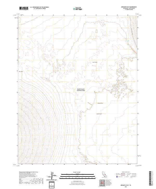
2021 Map of Mesquite Flat
USGS Topo · Published 2021About this map
Death Valley National Park encompasses most of this landscape, where the northern reaches of the Mojave Desert transition into the low-lying basin of Death Valley. The topography is dominated by the expansive Mesquite Flat, a broad alluvial expanse characterized by subtle elevation changes and complex drainage patterns. In the northwestern section of the quadrangle, the Niter Beds represent a distinct geological formation, while the presence of Triangle Spring in the northeast serves as a critical water point in this arid environment. Transportation is limited to the corridor of Scottys Castle Road, which skirts the eastern edge of the valley. This 2021 survey illustrates the modern management boundaries and the preservation of these natural features, providing a detailed look at the desert floor and the surrounding mountain foothills that define the eastern and western horizons.
Find a feature on this map
13 named features on this map. Tap any name to fly to it.
Don’t see what you’re looking for? This feature index may not catch every label — zoom into the map to look around manually.
Map Details
Editions of this 2021 Mesquite Flat Map
This is the sole edition of this map. No revisions or reprints were ever made.
Other maps of this area

1908 · Ballarat
USGS Topo · 1:250,000

1913 · Ballarat
USGS Topo · 1:250,000

1948 · Death Valley
USGS Topo · 1:250,000

1951 · Marble Canyon
USGS Topo · 1:62,500

1952 · Stovepipe Wells
USGS Topo · 1:62,500

1954 · Death Valley
USGS Topo · 1:250,000

1956 · Death Valley
USGS Topo · 1:250,000

1957 · Death Valley
USGS Topo · 1:250,000
1957 · Grapevine Peak
USGS Topo · 1:62,500

1957 · Tin Mountain
USGS Topo · 1:62,500