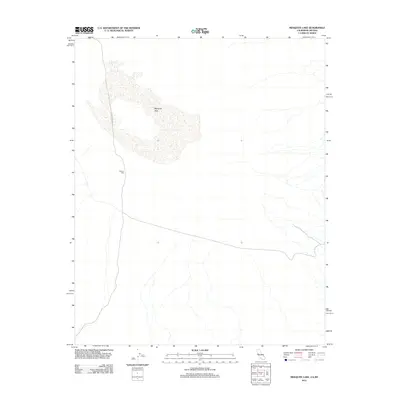
2012 Map of Mesquite Lake
USGS Topo · Published 2012About this map
Mesquite Lake dominates this arid landscape in San Bernardino County, appearing as a broad, dry lake bed characteristic of the Mojave desert region. The map captures the area's industrial and transit markers, most notably Greens Mill, which stands as a lone point of development in the desert floor. Movement through this sparse terrain is defined by Mesquite Pass Rd, a route that cuts across the western portion of the quadrangle near the California-Nevada border. This survey provides a precise look at the drainage patterns and desert tracks that define the basin, highlighting how isolated industrial sites like the mill utilize the flat, open geography of the lake region.
Find a feature on this map
3 named features on this map. Tap any name to fly to it.
Don’t see what you’re looking for? This feature index may not catch every label — zoom into the map to look around manually.
Map Details
Editions of this 2012 Mesquite Lake Map
This is the sole edition of this map. No revisions or reprints were ever made.
Other maps of this area

1910 · Ivanpah
USGS Topo · 1:250,000

1912 · Ivanpah
USGS Topo · 1:250,000

1942 · Ivanpah
USGS Topo · 1:250,000

1947 · Kingman
USGS Topo · 1:250,000

1948 · Kingman
USGS Topo · 1:250,000

1954 · Kingman
USGS Topo · 1:250,000

1955 · Kingman
USGS Topo · 1:250,000

1955 · Roach Lake
USGS Topo · 1:62,500

1956 · Clark Mountain
USGS Topo · 1:62,500

1956 · Shenandoah Peak
USGS Topo · 1:62,500