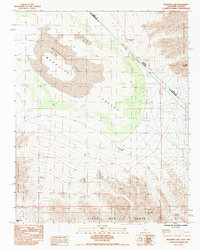
1985 Map of Mesquite Lake
USGS Topo · Published 1985About this map
Mesquite Lake and the arid floor of Mesquite Valley dominate this mid-1980s landscape at the high desert border of California and Nevada. This map records the difficult environmental reality of the region, where every labeled water source, including Government Well (Dry), Mesquite Well (Dry), and a third Well (Dry), is explicitly marked as dry. The terrain is defined by the enclosure of several prominent ranges, including the Spring Mountains to the east and the Clark Mtn Range and Mesquite Mountains to the south. Human activity is focused on mineral extraction and transit, evidenced by the Milford Mine near Lead Mountain, scattered Prospects, and the passage through Mesquite Pass. The Nevada California Boundary and the Clark Co San Bernardino Co line cut diagonally across the basin, highlighting the geopolitical divisions of this unpopulated desert corridor.
Find a feature on this map
14 named features on this map. Tap any name to fly to it.
Don’t see what you’re looking for? This feature index may not catch every label — zoom into the map to look around manually.
Map Details
Editions of this 1985 Mesquite Lake Map
This is the sole edition of this map. No revisions or reprints were ever made.
Other maps of this area

1910 · Ivanpah
USGS Topo · 1:250,000

1912 · Ivanpah
USGS Topo · 1:250,000

1942 · Ivanpah
USGS Topo · 1:250,000

1947 · Kingman
USGS Topo · 1:250,000

1948 · Kingman
USGS Topo · 1:250,000

1954 · Kingman
USGS Topo · 1:250,000

1955 · Kingman
USGS Topo · 1:250,000

1955 · Roach Lake
USGS Topo · 1:62,500

1956 · Clark Mountain
USGS Topo · 1:62,500

1956 · Shenandoah Peak
USGS Topo · 1:62,500