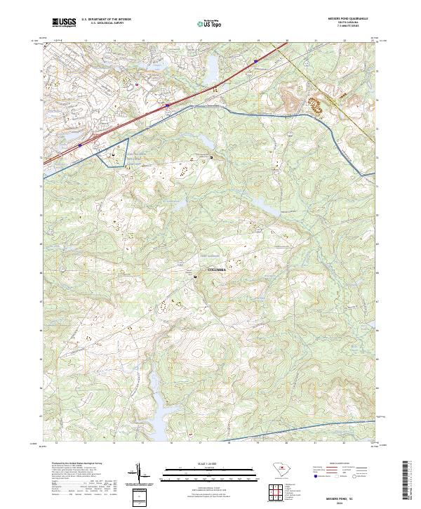
2024 Map of Messers Pond
USGS Topo · Published 2024About this map
Fort Jackson dominates this landscape northeast of Columbia, where military training grounds meet the wetlands of the South Carolina sandhills. This modern survey illustrates a complex hydrological network defined by family-named waters like Messers Pond, Cobbs Pond, and Old Barstow Pond, alongside the significant ecological features of Wise Marsh and Noahs Marsh. The eastern edge of the map follows the Kershaw and Richland county boundary, slicing through the drainages of Colonels Creek and Buffalo Creek.
Find a feature on this map
122 named features on this map. Tap any name to fly to it.
Don’t see what you’re looking for? This feature index may not catch every label — zoom into the map to look around manually.
Map Details
Editions of this 2024 Messers Pond Map
This is the sole edition of this map. No revisions or reprints were ever made.
Other maps of this area

1935 · Killian
USGS Topo · 1:48,000

1937 · Killian
USGS Topo · 1:62,500

1938 · Hagood
USGS Topo · 1:62,500

1941 · Spartanburg
USGS Topo · 1:250,000

1942 · Camden
USGS Topo · 1:125,000

1943 · Eastover
USGS Topo · 1:62,500

1948 · Hopkins
USGS Topo · 1:62,500

1953 · Messers Pond
USGS Topo · 1:24,000

1953 · Fort Jackson South
USGS Topo · 1:24,000

1953 · Blythewood
USGS Topo · 1:24,000