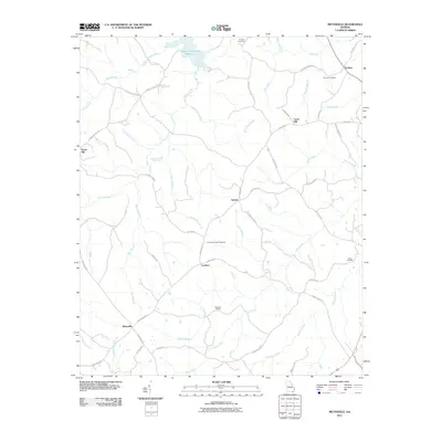
2011 Map of Metasville
USGS Topo · Published 2011About this map
Goshen and the surrounding hamlets of Lincoln County appear here in a landscape defined by small-scale crossroads and a dense network of creek branches. The northern edge of the map is dominated by the reach of the J. Strom Thurmond Reservoir, where Morris Creek and Fishing Creek meet the impounded waters. Moving south from the reservoir, the terrain transitions into an area of dispersed settlements and ancestral landmarks, including Midway Cemetery and Anthonys Chapel Cemetery. Evidence of local industry and geology is found at the Magruda Mines near the center of the sheet, situated between the communities of Lovelace and Metasville. The map's road network, featuring names like Goshen Church Rd and Metasville Rd, connects these rural hubs across a drainage system feeding into Soap Creek and Florence Creek.
Find a feature on this map
52 named features on this map. Tap any name to fly to it.
Don’t see what you’re looking for? This feature index may not catch every label — zoom into the map to look around manually.
Map Details
Editions of this 2011 Metasville Map
This is the sole edition of this map. No revisions or reprints were ever made.
Other maps of this area

1892 · Mc Cormick
USGS Topo · 1:125,000

1906 · Crawfordville
USGS Topo · 1:125,000

1912 · Mc Cormick
USGS Topo · 1:125,000

1921 · Appling
USGS Topo · 1:62,500

1943 · Appling
USGS Topo · 1:62,500

1953 · Athens
USGS Topo · 1:250,000

1954 · Metasville
USGS Topo · 1:24,000

1955 · Tignall
USGS Topo · 1:24,000

1955 · Broad
USGS Topo · 1:24,000

1955 · Chennault
USGS Topo · 1:24,000