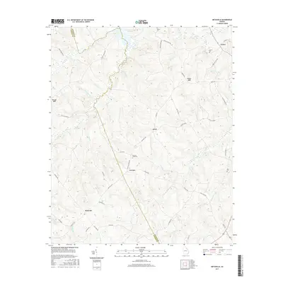
2017 Map of Metasville
USGS Topo · Published 2017About this map
Metasville and the surrounding rural landscape of Lincoln County and Wilkes County are defined by a network of small creeks and legacy family settlements. The northern edge of the map is dominated by the finger-like inlets of J. Strom Thurmond Reservoir, where waters like Gold Mine Branch and Mill Creek feed into the expansive reservoir system. This modern survey reflects a region where historical land use is still visible through its many family and community cemeteries, including Anthonys Chapel Cemetery and Goshen Cemetery. The road network, featuring names like Goshen Church Road and Metasville Road, connects scattered residential clusters such as Lovelace, Sybert, and Goshen. The topography is a complex arrangement of ridges and draws, with notable elevations at Curry Hill and Floral Hill overlooking a drainage system that includes Fishing Creek and Florence Creek.
Find a feature on this map
56 named features on this map. Tap any name to fly to it.
Don’t see what you’re looking for? This feature index may not catch every label — zoom into the map to look around manually.
Map Details
Editions of this 2017 Metasville Map
This is the sole edition of this map. No revisions or reprints were ever made.
Other maps of this area

1892 · Mc Cormick
USGS Topo · 1:125,000

1906 · Crawfordville
USGS Topo · 1:125,000

1912 · Mc Cormick
USGS Topo · 1:125,000

1921 · Appling
USGS Topo · 1:62,500

1943 · Appling
USGS Topo · 1:62,500

1953 · Athens
USGS Topo · 1:250,000

1954 · Metasville
USGS Topo · 1:24,000

1955 · Tignall
USGS Topo · 1:24,000

1955 · Broad
USGS Topo · 1:24,000

1955 · Chennault
USGS Topo · 1:24,000