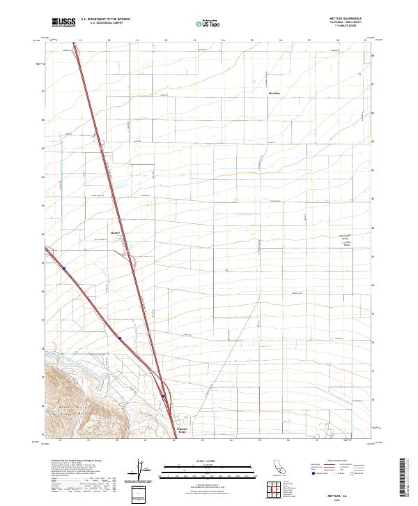
2021 Map of Mettler
USGS Topo · Published 2021About this map
San Joaquin Valley agriculture meets the foothills of the San Emigdio Mountains in this modern survey of the southern Central Valley. The landscape is defined by the massive infrastructure of the Governor Edmund G Brown California Aqueduct, which skirts the base of the Wheeler Ridge uplift. The settlement of Mettler serves as a central hub for the surrounding grid of local farm roads like Valpredo Rd and Mettler Frontage Rd E. Natural drainages such as Tecuya Cr and Grapevine Cr descend from the high ground into the valley floor, where they intersect man-made water systems including the 850 Canal. The presence of the Meridian marker and various township lines illustrates the continuing importance of the Public Land Survey System in organizing this productive agricultural landscape.
Find a feature on this map
39 named features on this map. Tap any name to fly to it.
Don’t see what you’re looking for? This feature index may not catch every label — zoom into the map to look around manually.
Map Details
Editions of this 2021 Mettler Map
This is the sole edition of this map. No revisions or reprints were ever made.
Other maps of this area

1903 · Mt. Pinos
USGS Topo · 1:125,000

1903 · Tejon
USGS Topo · 1:125,000

1910 · Buena Vista Lake
USGS Topo · 1:125,000

1912 · Buena Vista Lake
USGS Topo · 1:125,000

1914 · Caliente
USGS Topo · 1:125,000

1930 · Weed Patch
USGS Topo · 1:31,680

1930 · Arvin
USGS Topo · 1:31,680

1930 · Conner
USGS Topo · 1:31,680

1931 · West of Tejon Hills
USGS Topo · 1:31,680

1931 · Tejon Hills
USGS Topo · 1:31,680