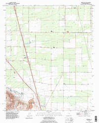
1992 Map of Mettler
USGS Topo · Published 1995About this map
Mettler and the surrounding agricultural lands of southern Kern County appear here as they were updated in the early 1990s. The landscape is defined by the rigid grid of irrigation and transport, featuring the Governor Brown California Aqueduct and a large Oil Field tucked against the northern slopes of Wheeler Ridge. This intersection of water infrastructure and petroleum extraction highlights the region's industrial foundations. Local landmarks such as the Pumping Station and various Gravel Pits dot the terrain, while settlements like Meridian and Wheeler Ridge serve as small hubs along major thoroughfares like the Maricopa Highway. The drainage of Tecuya Creek cuts through the surveyed sections, illustrating the natural watercourses that persist alongside man-made canals and pipelines in this intensive production landscape.
Find a feature on this map
52 named features on this map. Tap any name to fly to it.
Don’t see what you’re looking for? This feature index may not catch every label — zoom into the map to look around manually.
Map Details
Editions of this 1992 Mettler Map
This is the sole edition of this map. No revisions or reprints were ever made.
Other maps of this area

1903 · Mt. Pinos
USGS Topo · 1:125,000

1903 · Tejon
USGS Topo · 1:125,000

1910 · Buena Vista Lake
USGS Topo · 1:125,000

1912 · Buena Vista Lake
USGS Topo · 1:125,000

1914 · Caliente
USGS Topo · 1:125,000

1930 · Weed Patch
USGS Topo · 1:31,680

1930 · Arvin
USGS Topo · 1:31,680

1930 · Conner
USGS Topo · 1:31,680

1931 · West of Tejon Hills
USGS Topo · 1:31,680

1931 · Tejon Hills
USGS Topo · 1:31,680