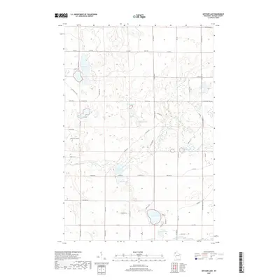
2018 Map of Metzger Lake
USGS Topo · Published 2018About this map
Metzger Lake and the surrounding pine-rich lowlands of Douglas County define this Northwoods landscape near the headwaters of the Eau Claire River. The area is characterized by a dense network of glacial kettle lakes and wetlands, connected by small drainage ways like Lower Ox Creek and Upper Ox Creek. Local transport is dictated by the terrain, with family and location-named routes such as Simms Lake Rd, Flamang Rd, and S Flat Lk Rd providing access to isolated shorelines and hunting grounds. Notable water bodies including Upper Ox Lake, Swenson Lake, and Whiteside Lake are surrounded by a grid of fire lanes and forest roads like Fire Lane Rd and Townline Rd. The map reveals a land primarily utilized for timber and seasonal recreation, where the names of small roads and remote lakes often reflect the genealogy of the families who settled this part of northern Wisconsin.
Find a feature on this map
62 named features on this map. Tap any name to fly to it.
Don’t see what you’re looking for? This feature index may not catch every label — zoom into the map to look around manually.
Map Details
Editions of this 2018 Metzger Lake Map
This is the sole edition of this map. No revisions or reprints were ever made.
Other maps of this area

1945 · Highland
USGS Topo · 1:48,000

1945 · Solon Springs
USGS Topo · 1:48,000

1947 · Chittamo
USGS Topo · 1:48,000

1947 · Minong
USGS Topo · 1:48,000

1949 · Solon Springs
USGS Topo · 1:48,000

1949 · Chittamo
USGS Topo · 1:48,000

1949 · Minong
USGS Topo · 1:48,000

1949 · Highland
USGS Topo · 1:48,000

1953 · Ashland
USGS Topo · 1:250,000

1958 · Ashland
USGS Topo · 1:250,000