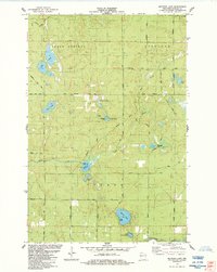
1984 Map of Metzger Lake
USGS Topo · Published 1984About this map
North Country National Scenic Trail winds through the northern timberlands of Douglas County, crossing a landscape defined by glacial kettle lakes and dense forests during the mid-1980s. This survey of the Solon Springs and Gordon townships captures a remote wilderness character where recreational camps like Camp Bovey sit near the shores of Metzger Lake. The map reveals a high concentration of water bodies, including the interconnected Twin Lakes and the secluded Swenson Lake, which are linked by a network of fire lanes and unimproved roads such as Flamang Road.
Find a feature on this map
46 named features on this map. Tap any name to fly to it.
Don’t see what you’re looking for? This feature index may not catch every label — zoom into the map to look around manually.
Map Details
Editions of this 1984 Metzger Lake Map
This is the sole edition of this map. No revisions or reprints were ever made.
Other maps of this area

1945 · Highland
USGS Topo · 1:48,000

1945 · Solon Springs
USGS Topo · 1:48,000

1947 · Chittamo
USGS Topo · 1:48,000

1947 · Minong
USGS Topo · 1:48,000

1949 · Solon Springs
USGS Topo · 1:48,000

1949 · Chittamo
USGS Topo · 1:48,000

1949 · Minong
USGS Topo · 1:48,000

1949 · Highland
USGS Topo · 1:48,000

1953 · Ashland
USGS Topo · 1:250,000

1958 · Ashland
USGS Topo · 1:250,000