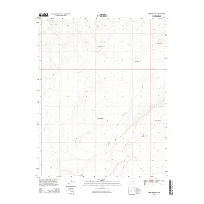
2014 Map of Mexican Hat SE
USGS Topo · Published 2014About this map
Cane Valley and the surrounding high desert topography dominate this 2014 survey of San Juan County. The landscape is defined by its drainage systems, including Halgaitoh Wash, the winding Gypsum Cr, and the southward-flowing Cane Valley Wash. Human movement through this arid terrain is traced by a network of specialized routes, notably Poncho House and the aptly named Mine Rd in the southern portion of the quadrangle. These roads suggest a landscape tied to archaeological significance and resource extraction. The eastern edge of the map features Comb Ridge Rd, running parallel to the dramatic geological uplift. Administrative designations like Bia 6440 and Co Road 423 provide a modern overlay to this ancient, water-carved environment, offering a detailed look at the infrastructure within the Navajo Nation region.
Find a feature on this map
13 named features on this map. Tap any name to fly to it.
Don’t see what you’re looking for? This feature index may not catch every label — zoom into the map to look around manually.
Map Details
Editions of this 2014 Mexican Hat SE Map
This is the sole edition of this map. No revisions or reprints were ever made.
Other maps of this area

1886 · Abajo
USGS Topo · 1:250,000

1892 · Abajo
USGS Topo · 1:250,000

1892 · Canyon De Chelly
USGS Topo · 1:250,000

1893 · Abajo
USGS Topo · 1:250,000

1952 · Bluff 3 SE
USGS Topo · 1:24,000

1952 · Dinnehotso
USGS Topo · 1:62,500
1952 · Bluff 3 SW
USGS Topo · 1:24,000

1952 · Setsiltso Springs 2 NW
USGS Topo · 1:24,000

1952 · Setsiltso Springs 2 NE
USGS Topo · 1:24,000

1954 · Shiprock
USGS Topo · 1:250,000