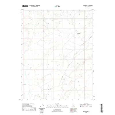
2020 Map of Mexican Hat SE
USGS Topo · Published 2020About this map
Cane Valley defines the landscape of this corner of San Juan County, Utah, where a sparse network of roads connects isolated desert terrain. The drainage of Cane Valley Wash and its tributary Gypsum Cr cut through the high ground, illustrating the natural watercourses that dictated movement in this arid region. The presence of Mine Rd suggests the area's history of extraction, while C R 491 - Poncho House and Cane Valley Wash Rd provide the primary routes through the valley. This 2020 edition captures the character of the southeastern corner of the Mexican Hat region, where public and private land boundaries intersect among the contour-etched mesas and washes.
Find a feature on this map
7 named features on this map. Tap any name to fly to it.
Don’t see what you’re looking for? This feature index may not catch every label — zoom into the map to look around manually.
Map Details
Editions of this 2020 Mexican Hat SE Map
This is the sole edition of this map. No revisions or reprints were ever made.
Other maps of this area

1886 · Abajo
USGS Topo · 1:250,000

1892 · Abajo
USGS Topo · 1:250,000

1892 · Canyon De Chelly
USGS Topo · 1:250,000

1893 · Abajo
USGS Topo · 1:250,000

1952 · Bluff 3 SE
USGS Topo · 1:24,000

1952 · Dinnehotso
USGS Topo · 1:62,500
1952 · Bluff 3 SW
USGS Topo · 1:24,000

1952 · Setsiltso Springs 2 NW
USGS Topo · 1:24,000

1952 · Setsiltso Springs 2 NE
USGS Topo · 1:24,000

1954 · Shiprock
USGS Topo · 1:250,000