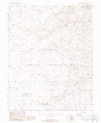
1988 Map of Mexican Hat SW
USGS Topo · Published 1988About this map
Halchita stands as a primary focal point in this high-desert region of the Navajo Indian Reservation. Published as a provisional sheet in the late 1980s, the map documents a landscape defined by its drainage systems and subtle elevation markers rather than dense urban development. The topography is shaped by prominent watercourses including Halgaitoh Wash and Eagle Rock Wash, which cut through the desert floor. Infrastructure is sparse, concentrated primarily around the modern utility markers of the Water Tanks and the path of highway 163. To the south, Gypsum Creek and Stagecoach Wash further illustrate the intricate network of seasonal flows that characterize this part of San Juan County, providing a detailed reference for the region's physical geography before the turn of the millennium.
Find a feature on this map
10 named features on this map. Tap any name to fly to it.
Don’t see what you’re looking for? This feature index may not catch every label — zoom into the map to look around manually.
Map Details
Editions of this 1988 Mexican Hat SW Map
This is the sole edition of this map. No revisions or reprints were ever made.
Other maps of this area

1883 · Marsh Pass
USGS Topo · 1:250,000

1886 · Henry Mountains
USGS Topo · 1:250,000

1886 · Abajo
USGS Topo · 1:250,000

1892 · Marsh Pass
USGS Topo · 1:250,000

1892 · Abajo
USGS Topo · 1:250,000

1892 · Henry Mountains
USGS Topo · 1:250,000

1892 · Canyon De Chelly
USGS Topo · 1:250,000

1893 · Abajo
USGS Topo · 1:250,000

1952 · Bluff 3 SE
USGS Topo · 1:24,000

1952 · Dinnehotso
USGS Topo · 1:62,500