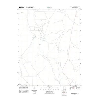
2011 Map of Mexican Water SW
USGS Topo · Published 2011About this map
Chinle Valley dominates this high-desert landscape in northern Arizona, where water sources dictate the movement across the terrain. Vital watering points like Sand Springs, Hummingbird Spring, and Sunnyside Spring appear alongside ephemeral drainage systems such as Blackhorse Wash. The map documents a network of named routes including Indian Rte 5052 and Indian Rte 5050, which traverse the open flats between significant elevations. These topographical markers, including the prominent Skinny Mesa to the north and Antelope Ridge at the southern edge, provide essential orientation in a region defined by its sparse but critical landmarks.
Find a feature on this map
15 named features on this map. Tap any name to fly to it.
Don’t see what you’re looking for? This feature index may not catch every label — zoom into the map to look around manually.
Map Details
Editions of this 2011 Mexican Water SW Map
This is the sole edition of this map. No revisions or reprints were ever made.
Other maps of this area

1892 · Canyon De Chelly
USGS Topo · 1:250,000

1952 · Dinnehotso
USGS Topo · 1:62,500

1952 · Setsiltso Springs 2 SE
USGS Topo · 1:24,000

1952 · Setsiltso Springs 2 NE
USGS Topo · 1:24,000

1954 · Shiprock
USGS Topo · 1:250,000

1958 · Shiprock
USGS Topo · 1:250,000

1959 · Shiprock
USGS Topo · 1:250,000
1968 · Mexican Water
USGS Topo · 1:24,000
1968 · Hogansaani Spring
USGS Topo · 1:24,000
1968 · Walker Creek Reservoir
USGS Topo · 1:24,000