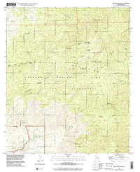
1996 Map of Mica Mountain
USGS Topo · Published 2002About this map
Mica Mountain dominates the high-altitude landscape of this mid-1990s survey, marking a rugged transition between the Saguaro National Park and the surrounding Coronado National Forest. This high desert environment is defined by its seasonal hydrology, where sites like Douglas Camp Spring and Grass Shack Spring are noted as dry, while perennially important spots such as Spud Rock Spring and Devils Bathtub Spring dot the mountain slopes. The map reveals the infrastructure of early conservation and resource management, including the Madrona Ranger Sta, a lookout tower at the summit, and the remote Manning Camp. In the lower Rincon Valley, the layout of the Rincon Ranch and evidence of local industry at a marked Mine show the human footprint along the banks of Rincon Creek.
Find a feature on this map
50 named features on this map. Tap any name to fly to it.
Don’t see what you’re looking for? This feature index may not catch every label — zoom into the map to look around manually.
Map Details
Editions of this 1996 Mica Mountain Map
This is the sole edition of this map. No revisions or reprints were ever made.
Other maps of this area

1904 · Tucson
USGS Topo · 1:125,000

1905 · Tucson
USGS Topo · 1:125,000

1945 · Redington
USGS Topo · 1:62,500

1945 · Happy Valley
USGS Topo · 1:62,500

1956 · Tucson
USGS Topo · 1:250,000

1957 · Bellota Ranch
USGS Topo · 1:62,500

1957 · Rincon Valley
USGS Topo · 1:62,500

1957 · Redington
USGS Topo · 1:62,500

1958 · Tucson
USGS Topo · 1:250,000

1958 · Happy Valley
USGS Topo · 1:62,500