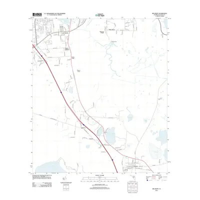
2012 Map of Micanopy
USGS Topo · Published 2012About this map
Paynes Prairie dominates the central landscape of this 2012 survey, illustrating the unique hydrologic character of the Alachua Sink region. The map highlights the historic town of Micanopy, showing its well-preserved street grid and the Micanopy Historic Cem at its southern edge. To the north, the suburban expansion of Gainesville is evident in developments like Robinson Heights, Idylwild, and Malore Gardens.
Find a feature on this map
108 named features on this map. Tap any name to fly to it.
Don’t see what you’re looking for? This feature index may not catch every label — zoom into the map to look around manually.
Map Details
Editions of this 2012 Micanopy Map
This is the sole edition of this map. No revisions or reprints were ever made.
Other maps of this area

1890 · Arredondo
USGS Topo · 1:62,500

1892 · Arredondo
USGS Topo · 1:62,500

1893 · Citra
USGS Topo · 1:62,500

1894 · Arredondo
USGS Topo · 1:62,500

1895 · Williston
USGS Topo · 1:62,500

1895 · Citra
USGS Topo · 1:62,500

1938 · Hawthorn
USGS Topo · 1:48,000

1943 · Hawthorn
USGS Topo · 1:62,500

1954 · Gainesville
USGS Topo · 1:250,000

1958 · Gainesville
USGS Topo · 1:250,000