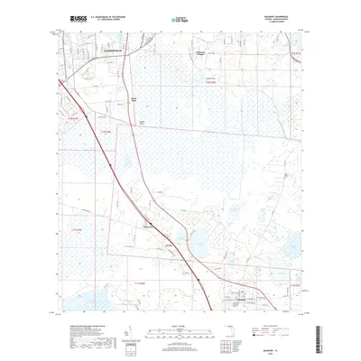
2018 Map of Micanopy
USGS Topo · Published 2018About this map
Paynes Prairie dominates the central landscape of this Alachua County study, a massive basin where water levels and marshy terrain dictate the layout of human settlement. The northern edge is defined by the expansion of Gainesville, with neighborhoods like Robinson Heights and Rocky Point situated on higher ground overlooking the wet prairie. A distinct corridor of development follows the road network southeast toward the town of Micanopy, passing through smaller localities such as Kirkwood and Tacoma.
Find a feature on this map
113 named features on this map. Tap any name to fly to it.
Don’t see what you’re looking for? This feature index may not catch every label — zoom into the map to look around manually.
Map Details
Editions of this 2018 Micanopy Map
This is the sole edition of this map. No revisions or reprints were ever made.
Other maps of this area

1890 · Arredondo
USGS Topo · 1:62,500

1892 · Arredondo
USGS Topo · 1:62,500

1893 · Citra
USGS Topo · 1:62,500

1894 · Arredondo
USGS Topo · 1:62,500

1895 · Williston
USGS Topo · 1:62,500

1895 · Citra
USGS Topo · 1:62,500

1938 · Hawthorn
USGS Topo · 1:48,000

1943 · Hawthorn
USGS Topo · 1:62,500

1954 · Gainesville
USGS Topo · 1:250,000

1958 · Gainesville
USGS Topo · 1:250,000