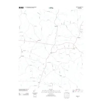
2013 Map of Michie
USGS Topo · Published 2013About this map
Michie serves as the central hub of this McNairy County landscape, situated at the intersection of several local routes in southern Tennessee. The topography is defined by the drainages of Lick Cr, Little Lick Cr, and the Lick Cr Canal, which flow through a network of small settlements and family-named roads. Rural communities such as Needmore, Pebble Hill, and Chambers are connected by roads like Chambers Store Rd and State Hwy 22-57 Cutoff, reflecting a long-standing pattern of localized agriculture and commerce. To the south, Acton and Liberty sit near the meandering Chambers Cr, while the western edge of the map features New Hope and Caffey. This 2013 survey provides a clear view of the modern road network superimposed over the traditional hollows and spring-fed branches like Donald Springs Br.
Find a feature on this map
88 named features on this map. Tap any name to fly to it.
Don’t see what you’re looking for? This feature index may not catch every label — zoom into the map to look around manually.
Map Details
Editions of this 2013 Michie Map
This is the sole edition of this map. No revisions or reprints were ever made.
Other maps of this area

1935 · Doskie
USGS Topo · 1:24,000

1936 · Counce
USGS Topo · 1:24,000

1936 · Kendrick
USGS Topo · 1:24,000

1936 · Pittsburg Landing
USGS Topo · 1:24,000

1936 · Purdy
USGS Topo · 1:24,000

1936 · Stantonville
USGS Topo · 1:24,000

1936 · Michie
USGS Topo · 1:24,000

1949 · Pittsburg Landing
USGS Topo · 1:24,000

1949 · Purdy
USGS Topo · 1:24,000

1949 · Stantonville
USGS Topo · 1:24,000