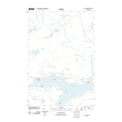
2011 Map of Michigamme
USGS Topo · Published 2011About this map
Lake Michigamme dominates this portion of the Upper Peninsula, its waters broken by Sundstrum Island and Ramsay Island. The village of Michigamme sits on the western shore, where local infrastructure is represented by the Michigamme Post Office and the Lakeview Cemetery. This landscape is defined by its complex hydrography, featuring the Peshekee River and its western branch flowing through a dense network of smaller bodies like Lake Sixteen, Lake Keewaydin, and the Van Riper Lakes.
Find a feature on this map
40 named features on this map. Tap any name to fly to it.
Don’t see what you’re looking for? This feature index may not catch every label — zoom into the map to look around manually.
Map Details
Editions of this 2011 Michigamme Map
This is the sole edition of this map. No revisions or reprints were ever made.
Other maps of this area

1899 · Witbeck
USGS Topo · 1:62,500

1955 · Champion
USGS Topo · 1:24,000

1955 · Witch Lake NE
USGS Topo · 1:24,000

1955 · Republic
USGS Topo · 1:62,500

1955 · Republic
USGS Topo · 1:24,000

1955 · Witch Lake
USGS Topo · 1:62,500

1955 · Champion
USGS Topo · 1:62,500

1956 · Three Lakes
USGS Topo · 1:24,000

1956 · Michigamme
USGS Topo · 1:62,500

1956 · Michigamme
USGS Topo · 1:24,000