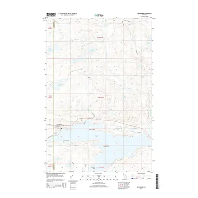
2014 Map of Michigamme
USGS Topo · Published 2014About this map
Lake Michigamme dominates the southern landscape of this Upper Peninsula survey, centered on the settlement of Michigamme. The town is situated on the lake's northern shore along Us-41, where local history is anchored at Lakeview Cem near the junction of W Main St and S Brook St. The surrounding terrain is defined by a complex network of waterways, including the Peshekee River and its branches, which feed into numerous smaller basins like Lake Sixteen and Mud Lake. Prominent geographical features within the lake include Presbytery Point, Sundstrum Island, and Ramsay Island. Further north, the landscape becomes increasingly remote, marked by isolated features such as Dee Lundeen Falls and Little White Goat Lake. The map details the transition between Marquette and Baraga counties, with the Peshekee Grade providing a clear trace of the region's industrial and logging transportation history.
Find a feature on this map
55 named features on this map. Tap any name to fly to it.
Don’t see what you’re looking for? This feature index may not catch every label — zoom into the map to look around manually.
Map Details
Editions of this 2014 Michigamme Map
This is the sole edition of this map. No revisions or reprints were ever made.
Other maps of this area

1899 · Witbeck
USGS Topo · 1:62,500

1955 · Champion
USGS Topo · 1:24,000

1955 · Witch Lake NE
USGS Topo · 1:24,000

1955 · Republic
USGS Topo · 1:62,500

1955 · Republic
USGS Topo · 1:24,000

1955 · Witch Lake
USGS Topo · 1:62,500

1955 · Champion
USGS Topo · 1:62,500

1956 · Three Lakes
USGS Topo · 1:24,000

1956 · Michigamme
USGS Topo · 1:62,500

1956 · Michigamme
USGS Topo · 1:24,000