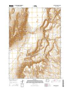
2014 Map of Mickey Springs
USGS Topo · Published 2014About this map
Mickey Butte dominates this arid landscape in Harney County, rising above the low-lying thermal features and desert basins of southeastern Oregon. The map centers on the geologic activity of the region, specifically Mickey Springs, a site noted for its geothermal character. To the north, the terrain transitions into the Mickey Basin, where Crippled Horse Spring provides a named water source in a predominantly dry environment. The presence of Ancient Lake to the east suggests the region's hydrographic history and the ephemeral nature of water in this high-desert territory. Surveyed by the U.S. Geological Survey, this topographic record illustrates the stark relief between the butte and the surrounding flats, defined by the Public Land Survey System grids of T32S and T33S.
Find a feature on this map
9 named features on this map. Tap any name to fly to it.
Don’t see what you’re looking for? This feature index may not catch every label — zoom into the map to look around manually.
Map Details
Editions of this 2014 Mickey Springs Map
This is the sole edition of this map. No revisions or reprints were ever made.
Other maps of this area

1955 · Adel
USGS Topo · 1:250,000

1957 · Adel
USGS Topo · 1:250,000

1958 · Adel
USGS Topo · 1:250,000

1962 · Adel
USGS Topo · 1:250,000

1981 · Coyote Lake West
USGS Topo · 1:24,000
1981 · Mann Lake
USGS Topo · 1:24,000
1981 · Johnny Creek SW
USGS Topo · 1:24,000

1981 · Ancient Lake Well
USGS Topo · 1:24,000

1981 · Miranda Flat SW
USGS Topo · 1:24,000

1981 · Miranda Flat SE
USGS Topo · 1:24,000