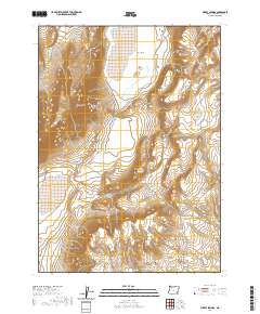
2020 Map of Mickey Springs
USGS Topo · Published 2020About this map
Mickey Basin and the surrounding high desert of Harney County are defined here by essential water sources and the singular Mickey Alvord Wells Rd track. This arid landscape is anchored by Mickey Springs at the base of the prominent Mickey Butte, while Crippled Horse Spring provides a rare point of reference to the north. The survey illustrates a terrain of steep elevation changes and drainage patterns that dictate travel and land use in this part of southeastern Oregon. The lack of permanent structures emphasizes the region's character as open range or protected land, where named springs and volcanic buttes serve as the primary landmarks for navigation and local history.
Find a feature on this map
9 named features on this map. Tap any name to fly to it.
Don’t see what you’re looking for? This feature index may not catch every label — zoom into the map to look around manually.
Map Details
Editions of this 2020 Mickey Springs Map
This is the sole edition of this map. No revisions or reprints were ever made.
Other maps of this area

1955 · Adel
USGS Topo · 1:250,000

1957 · Adel
USGS Topo · 1:250,000

1958 · Adel
USGS Topo · 1:250,000

1962 · Adel
USGS Topo · 1:250,000

1981 · Coyote Lake West
USGS Topo · 1:24,000
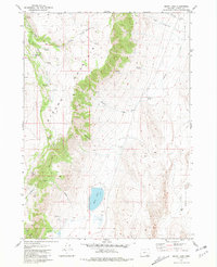
1981 · Mann Lake
USGS Topo · 1:24,000
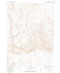
1981 · Johnny Creek SW
USGS Topo · 1:24,000

1981 · Ancient Lake Well
USGS Topo · 1:24,000

1981 · Miranda Flat SW
USGS Topo · 1:24,000

1981 · Miranda Flat SE
USGS Topo · 1:24,000