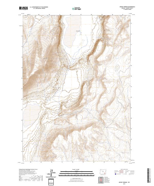
2023 Map of Mickey Springs
USGS Topo · Published 2023About this map
Mickey Butte dominates the central landscape of this Harney County terrain, rising sharply above the desert floor to provide a significant landmark for the region. The high-desert geography is characterized by its vital water sources, including the isolated Mickey Springs and Crippled Horse Spring found within Mickey Basin. These springs have long been essential stopovers in the arid Great Basin landscape, serving as reliable points of interest for early travelers and current land managers alike. Connectivity through this sparse environment is maintained by the Mickey Alvord Wells Rd, which skirts the western edge of the butte. The 2023 data reflects the enduring nature of these landforms and water points in a part of Oregon where the physical features remain the primary markers of human passage and activity.
Find a feature on this map
9 named features on this map. Tap any name to fly to it.
Don’t see what you’re looking for? This feature index may not catch every label — zoom into the map to look around manually.
Map Details
Editions of this 2023 Mickey Springs Map
This is the sole edition of this map. No revisions or reprints were ever made.
Other maps of this area

1955 · Adel
USGS Topo · 1:250,000

1957 · Adel
USGS Topo · 1:250,000

1958 · Adel
USGS Topo · 1:250,000

1962 · Adel
USGS Topo · 1:250,000

1981 · Coyote Lake West
USGS Topo · 1:24,000
1981 · Mann Lake
USGS Topo · 1:24,000
1981 · Johnny Creek SW
USGS Topo · 1:24,000

1981 · Ancient Lake Well
USGS Topo · 1:24,000

1981 · Miranda Flat SW
USGS Topo · 1:24,000

1981 · Miranda Flat SE
USGS Topo · 1:24,000