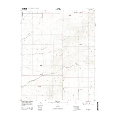
2015 Map of Mid Hills
USGS Topo · Published 2015About this map
Cima serves as a primary geographic anchor in this 2015 U.S. Geological Survey representation of the high desert, where the arid landscape is defined by its vital water sources and remote outposts. Scattered springs like Bathtub Spring, Live Oak Spring, and Burro Spring suggest the precarious survival of life and livestock in this environment. The presence of Thomas Place and the Mid Hills settlement, situated along a network of primitive roads including Morning Star Mine Rd and Cedar Canyon Rd, highlights the long-standing human adaptation to the high-elevation terrain within the Mojave National Preserve. Geologically, the area is carved by significant drainages such as Kelso Wash and Cedar Wash, while landmarks like Butcher Knife Canyon and Round Valley illustrate the complex topography that historically directed travel and land use in this part of San Bernardino County.
Find a feature on this map
25 named features on this map. Tap any name to fly to it.
Don’t see what you’re looking for? This feature index may not catch every label — zoom into the map to look around manually.
Map Details
Editions of this 2015 Mid Hills Map
This is the sole edition of this map. No revisions or reprints were ever made.
Other maps of this area

1910 · Ivanpah
USGS Topo · 1:250,000

1912 · Ivanpah
USGS Topo · 1:250,000

1942 · Ivanpah
USGS Topo · 1:250,000

1947 · Kingman
USGS Topo · 1:250,000

1948 · Kingman
USGS Topo · 1:250,000

1954 · Kingman
USGS Topo · 1:250,000

1955 · Kingman
USGS Topo · 1:250,000

1955 · Mescal Range
USGS Topo · 1:62,500

1955 · Mid Hills
USGS Topo · 1:62,500

1955 · Kelso
USGS Topo · 1:62,500