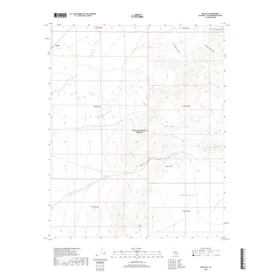
2018 Map of Mid Hills
USGS Topo · Published 2018About this map
The Mojave National Preserve protects this arid upland landscape where the high desert meets the southern reaches of the New York Mountains. Centered on the Mid Hills and Round Valley, the map details a topography defined by complex drainage systems and isolated water sources. Seasonal watercourses like Kelso Wash and Cedar Wash intersect with deep topographical cuts such as Butcher Knife Canyon and Cottonwood Canyon. The distribution of vital desert resources is marked by several named watering points, including Burro Spring, Cabin Spring, and Live Oak Spring. These features, along with Pinto Mtn, highlight the reliance on specific geographic landmarks for navigation and survival in the high Mojave Desert.
Find a feature on this map
23 named features on this map. Tap any name to fly to it.
Don’t see what you’re looking for? This feature index may not catch every label — zoom into the map to look around manually.
Map Details
Editions of this 2018 Mid Hills Map
This is the sole edition of this map. No revisions or reprints were ever made.
Other maps of this area

1910 · Ivanpah
USGS Topo · 1:250,000

1912 · Ivanpah
USGS Topo · 1:250,000

1942 · Ivanpah
USGS Topo · 1:250,000

1947 · Kingman
USGS Topo · 1:250,000

1948 · Kingman
USGS Topo · 1:250,000

1954 · Kingman
USGS Topo · 1:250,000

1955 · Kingman
USGS Topo · 1:250,000

1955 · Mescal Range
USGS Topo · 1:62,500

1955 · Mid Hills
USGS Topo · 1:62,500

1955 · Kelso
USGS Topo · 1:62,500