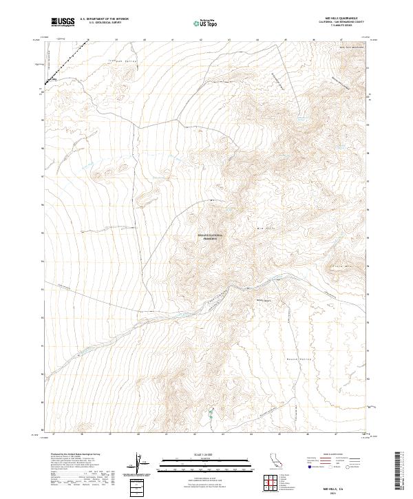
2021 Map of Mid Hills
USGS Topo · Published 2021About this map
Cima serves as a small anchor for this desert landscape, situated at the edge of the Ivanpah Valley and the New York Mountains. This area of the Mojave National Preserve is defined by a network of drainage systems and isolated water sources, including Kelso Wash and a series of springs such as Burro Spring, Live Oak Spring, and Bathtub Spring. These perennial points of water were historically critical for travel and ranching in the high desert.
Find a feature on this map
29 named features on this map. Tap any name to fly to it.
Don’t see what you’re looking for? This feature index may not catch every label — zoom into the map to look around manually.
Map Details
Editions of this 2021 Mid Hills Map
This is the sole edition of this map. No revisions or reprints were ever made.
Other maps of this area

1910 · Ivanpah
USGS Topo · 1:250,000

1912 · Ivanpah
USGS Topo · 1:250,000

1942 · Ivanpah
USGS Topo · 1:250,000

1947 · Kingman
USGS Topo · 1:250,000

1948 · Kingman
USGS Topo · 1:250,000

1954 · Kingman
USGS Topo · 1:250,000

1955 · Kingman
USGS Topo · 1:250,000

1955 · Mescal Range
USGS Topo · 1:62,500

1955 · Mid Hills
USGS Topo · 1:62,500

1955 · Kelso
USGS Topo · 1:62,500