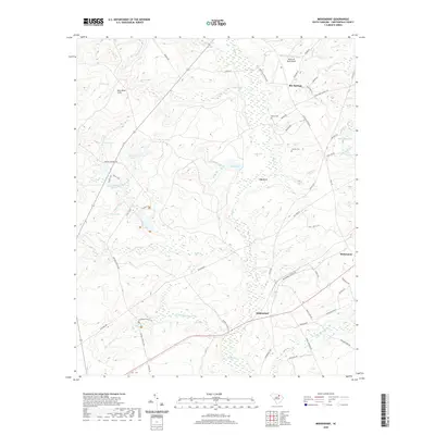
2020 Map of Middendorf
USGS Topo · Published 2020About this map
Middendorf and the surrounding Chesterfield County landscape are defined by a network of tributaries feeding into Black Cr and Little Alligator Cr. The area is characterized by a high concentration of managed water bodies and ponds, including Lake Number Twelve, Lake Number Sixteen, and Triple Lakes, interspersed with the sandy elevations of the King Sand Hills. Cultural history is anchored by rural settlements like Bay Springs and McKennon, alongside family-named landmarks such as Brown Cem and Cassidy Cem. The presence of the Wild Irish Rose Airport and a complex trail system including Tates Trail and Tripod Trail suggests a landscape utilized for both local aviation and recreation. Transportation follows a mix of established routes like Old Wire Rd and local connectors such as Middendorf Church Rd, showing how the community has navigated the drainage basins and wetlands of the coastal plain.
Find a feature on this map
68 named features on this map. Tap any name to fly to it.
Don’t see what you’re looking for? This feature index may not catch every label — zoom into the map to look around manually.
Map Details
Editions of this 2020 Middendorf Map
This is the sole edition of this map. No revisions or reprints were ever made.
Other maps of this area

1941 · Spartanburg
USGS Topo · 1:250,000

1953 · Spartanburg
USGS Topo · 1:250,000

1960 · Spartanburg
USGS Topo · 1:250,000

1963 · Spartanburg
USGS Topo · 1:250,000

1964 · Spartanburg
USGS Topo · 1:250,000

1967 · Angelus
USGS Topo · 1:24,000

1968 · Chesterfield
USGS Topo · 1:24,000

1968 · Patrick
USGS Topo · 1:24,000

1968 · Middendorf
USGS Topo · 1:24,000

1968 · Ruby
USGS Topo · 1:24,000