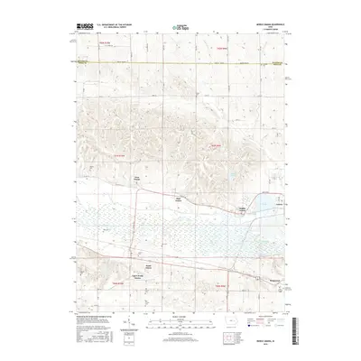
2015 Map of Middle Amana
USGS Topo · Published 2015About this map
The Iowa River corridor in this 2015 survey reveals the distinct settlement patterns of the Amana Colonies. Clustered villages including Middle Amana, High Amana, and West Amana are linked by the historical Mill Race waterway, reflecting a unique communal heritage and intentional land use that survives into the modern era. The landscape transitions from the river's wetland edge to the agricultural uplands of Benton Co and Iowa Co.
Find a feature on this map
49 named features on this map. Tap any name to fly to it.
Don’t see what you’re looking for? This feature index may not catch every label — zoom into the map to look around manually.
Map Details
Editions of this 2015 Middle Amana Map
This is the sole edition of this map. No revisions or reprints were ever made.
Other maps of this area

1888 · Amana
USGS Topo · 1:62,500

1889 · Amana
USGS Topo · 1:62,500

1891 · Oxford
USGS Topo · 1:62,500

1894 · Oxford
USGS Topo · 1:62,500

1899 · Amana
USGS Topo · 1:62,500

1903 · Fairfax
USGS Topo · 1:125,000

1954 · Des Moines
USGS Topo · 1:250,000

1956 · Des Moines
USGS Topo · 1:250,000

1957 · Des Moines
USGS Topo · 1:250,000

1958 · Davenport
USGS Topo · 1:250,000