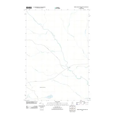
2011 Map of Middle Brook Mountain
USGS Topo · Published 2011About this map
Mooseleuk Stream and its numerous tributaries dominate this landscape in northern Maine, tracing a complex drainage network that eventually feeds the Aroostook River in the southeast corner. The terrain is defined by the prominent rise of Middle Brook Mountain, while human activity is evidenced by a network of logging and access roads including Pelletier Rd, Pinkham Rd, and Oxbow Rd.
Find a feature on this map
19 named features on this map. Tap any name to fly to it.
Don’t see what you’re looking for? This feature index may not catch every label — zoom into the map to look around manually.
Map Details
Editions of this 2011 Middle Brook Mountain Map
This is the sole edition of this map. No revisions or reprints were ever made.
Other maps of this area

1930 · Greenlaw
USGS Topo · 1:48,000

1931 · Mooseleuk Lake
USGS Topo · 1:48,000

1933 · Greenlaw
USGS Topo · 1:62,500

1935 · Mooseleuk Lake
USGS Topo · 1:62,500

1954 · Millinocket Lake
USGS Topo · 1:62,500

1954 · Grand Lake Seboeis
USGS Topo · 1:62,500

1954 · Presque Isle
USGS Topo · 1:250,000

1958 · Presque Isle
USGS Topo · 1:250,000

1960 · Presque Isle
USGS Topo · 1:250,000
1963 · Mooseleuk Lake
USGS Topo · 1:62,500