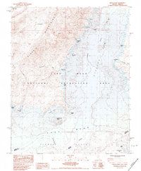
1983 Map of Middle Point
USGS Topo · Published 1984About this map
Lake Mead and its intricate shoreline dominate this topographic study at the confluence of the Virgin River and the Colorado River. Situated within the Lake Mead National Recreation Area, the map captures the desert landscape where the Overton Arm meets the main body of the reservoir. Notable shoreline features include numerous coves and landmarks such as Boathouse Cove, Miners Cove, and Ebony Cove. The rugged western backdrop is formed by the Black Mountains and Echo Hills, with the distinctive Cleopatra peak rising above the Cleopatra Cove.
Find a feature on this map
31 named features on this map. Tap any name to fly to it.
Don’t see what you’re looking for? This feature index may not catch every label — zoom into the map to look around manually.
Map Details
Editions of this 1983 Middle Point Map
This is the sole edition of this map. No revisions or reprints were ever made.
Other maps of this area

1886 · Saint Thomas
USGS Topo · 1:250,000

1893 · Saint Thomas
USGS Topo · 1:250,000

1926 · Bonelli
USGS Topo · 1:96,000

1926 · Boulder Canyon
USGS Topo · 1:96,000

1953 · Muddy Peak
USGS Topo · 1:62,500

1953 · Overton Beach
USGS Topo · 1:62,500

1953 · Hoover Dam
USGS Topo · 1:62,500

1953 · Virgin Basin
USGS Topo · 1:62,500

1954 · Las Vegas
USGS Topo · 1:250,000

1957 · Las Vegas
USGS Topo · 1:250,000