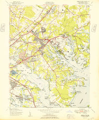
1951 Map of Middle River
USGS Topo · Published 1951About this map
Industrial and maritime activity define the eastern Baltimore County coastline in this mid-century survey. The landscape is a complex network of tidal inlets and peninsulas, dominated by the aeronautical presence of the Airport and the Baltimore Depot US Army Signal Corps. Substantial residential developments like Essex, Gray Manor, and Inverness appear alongside vital infrastructure such as the Baltimore City Back River Sewage Works. Transportation corridors including the Pennsylvania railroad and General Pulaski Highway bridge the gaps between tidal waters like Frog Mortar Creek and Sue Creek. Local history is anchored by landmarks such as the North Point Battlefield Monument and the United Clay Mines Mine No 2, while the coastline is dotted with recreational spots like Breezy Point Beach and Wildwood Beach. The map also captures the Essex Seaplane Base, highlighting the era's reliance on the protected waters of the Patapsco River.
Find a feature on this map
110 named features on this map. Tap any name to fly to it.
Don’t see what you’re looking for? This feature index may not catch every label — zoom into the map to look around manually.
Map Details
Editions of this 1951 Middle River Map
This is the sole edition of this map. No revisions or reprints were ever made.
Other maps of this area

1893 · North Point
USGS Topo · 1:62,500

1893 · Gunpowder
USGS Topo · 1:62,500

1894 · Baltimore
USGS Topo · 1:62,500

1894 · Relay
USGS Topo · 1:62,500

1898 · Tolchester
USGS Topo · 1:125,000

1899 · Baltimore
USGS Topo · 1:62,500

1901 · Gunpowder
USGS Topo · 1:62,500

1903 · Tolchester
USGS Topo · 1:125,000

1904 · Baltimore
USGS Topo · 1:62,500

1904 · North Point
USGS Topo · 1:62,500