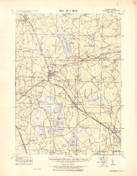
1918 Map of Middleboro
USGS Topo · Published 1921About this map
Assawompsett Pond and the surrounding wetlands of Plymouth County dominate this tactical survey, highlighting the complex water and rail networks of the early twentieth century. The Old Colony Railroad serves as the primary infrastructure backbone, with several specialized lines including the Plymouth & Middleboro Branch and the New Bedford Branch connecting rural outposts. Local industrial and institutional life is marked by sites like Paper Mill Village and the Lakeville State Sanatarium. The landscape is a mosaic of massive cedar swamps, including the Great Cedar Swamp and Little Cedar Swamp, interspersed with small named settlements such as The Green, Eddyville, and Rock Station. Significant geological and folklore-rich features like Sampsons Cave and the curiously named Mad Mare's Neck provide specific landmarks for genealogists and local historians tracing old property lines and family origins in this part of southeastern Massachusetts.
Find a feature on this map
134 named features on this map. Tap any name to fly to it.
Don’t see what you’re looking for? This feature index may not catch every label — zoom into the map to look around manually.
Map Details
Editions of this 1918 Middleboro Map
This is the sole edition of this map. No revisions or reprints were ever made.
Other maps of this area

1885 · New Bedford
USGS Topo · 1:62,500

1885 · Abington
USGS Topo · 1:62,500

1885 · Duxbury
USGS Topo · 1:62,500

1885 · Middleboro
USGS Topo · 1:62,500

1885 · Taunton
USGS Topo · 1:62,500

1886 · Falmouth
USGS Topo · 1:62,500

1886 · Plymouth
USGS Topo · 1:62,500

1886 · Dedham
USGS Topo · 1:62,500

1888 · Duxbury
USGS Topo · 1:62,500

1888 · New Bedford
USGS Topo · 1:62,500