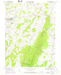
1968 Map of Middleburg
USGS Topo · Published 1978About this map
Middleburg and the surrounding horse country of northern Virginia are documented in this 1968 study, with updates through the late 1970s. The landscape is defined by its agrarian roots and social institutions, from the Glenwood Racetrack in the north to the Hill Sch and St Stephens the Martyr Ch in town. As the terrain rises toward the Bull Run Mountains, the map reveals a transition from the established village life of Aldie and Dover to the residential development at Bull Run Mountain Estates. Genealogists will find significant value in the numerous recorded burial grounds, including Sharon Cem and Memorial Cem, alongside rural landmarks like Mt Pleasant Ch and Long Branch Ch. Industrial history is preserved in labels for Burnt Mill and various quarries that once utilized the drainage of the Little River and Bull Run.
Find a feature on this map
55 named features on this map. Tap any name to fly to it.
Don’t see what you’re looking for? This feature index may not catch every label — zoom into the map to look around manually.
Map Details
Editions of this 1968 Middleburg Map
3 editions found
Other maps of this area

1884 · Harpers Ferry
USGS Topo · 1:125,000

1891 · Harpers Ferry
USGS Topo · 1:125,000

1893 · Harpers Ferry
USGS Topo · 1:125,000

1894 · Warrenton
USGS Topo · 1:125,000

1916 · Berryville
USGS Topo · 1:62,500

1933 · Middleburg
USGS Topo · 1:62,500

1939 · Berryville
USGS Topo · 1:48,000

1943 · Arcola
USGS Topo · 1:24,000

1943 · Bluemont
USGS Topo · 1:24,000

1943 · Thorofare Gap
USGS Topo · 1:24,000