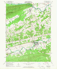
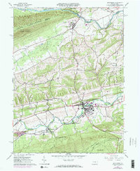
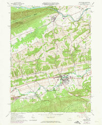
1965 Map of Middleburg
USGS Topo · Published 1966About this map
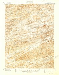
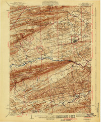
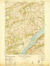
The borough of Middleburg serves as the central hub of this mid-1960s topographic record, where the Pennsylvania railroad line parallels Middle Creek through the heart of Snyder County. The landscape is defined by the heavy ridges of Jacks Mountain and Shade Mountain, which flank a valley rich with agricultural and industrial activity. Small rural communities like Paxtonville and the uniquely named Coon Hunter are connected by a network of backroads dotted with numerous country churches and family burial grounds, including St Lukes Ch and Salem Ch.
Find a feature on this map
53 named features on this map. Tap any name to fly to it.
Don’t see what you’re looking for? This feature index may not catch every label — zoom into the map to look around manually.
Map Details
Editions of this 1965 Middleburg Map
3 editions found
Other maps of this area

1893 · Sunbury
USGS Topo · 1:62,500

1893 · Millersburg
USGS Topo · 1:62,500

1907 · Millerstown
USGS Topo · 1:62,500
1938 · Mifflinburg
USGS Topo · 1:48,000

1943 · Millerstown
USGS Topo · 1:62,500

1943 · Millersburg
USGS Topo · 1:62,500

1943 · Sunbury
USGS Topo · 1:62,500
1943 · Mifflinburg
USGS Topo · 1:62,500
1947 · Dalmatia
USGS Topo · 1:24,000

1950 · Harrisburg
USGS Topo · 1:250,000