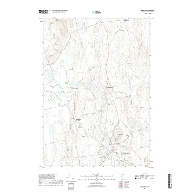
2018 Map of Middlebury
USGS Topo · Published 2018About this map
The town of Middlebury and the campus of Middlebury College anchor the southern reaches of this landscape, where the Otter Creek winds northward through a valley of limestone ledges and historic farmsteads. The terrain is defined by distinct elevations like Chipman Hill and The Ledge, with the New Haven River and Lemon Fair River feeding the drainage network of the Champlain Valley. Smaller clusters like Weybridge Hill, Beldens, and Brooksville are connected by a network of rural roads such as Morgan Horse Farm Rd and Quaker Village Rd. Genealogists will find a high density of burial grounds throughout the area, from the Old Middlebury Cem near the town center to more remote sites like Sunset View Cem and First Weybridge Hill Cem. The presence of Axinn Airport and the Vermont Bridge reflect the local infrastructure that supports this historic collegiate and agricultural community.
Find a feature on this map
91 named features on this map. Tap any name to fly to it.
Don’t see what you’re looking for? This feature index may not catch every label — zoom into the map to look around manually.
Map Details
Editions of this 2018 Middlebury Map
This is the sole edition of this map. No revisions or reprints were ever made.
Other maps of this area

1894 · Port Henry
USGS Topo · 1:62,500

1894 · Ticonderoga
USGS Topo · 1:62,500

1896 · Ticonderoga
USGS Topo · 1:62,500

1898 · Port Henry
USGS Topo · 1:62,500

1902 · Ticonderoga
USGS Topo · 1:62,500

1902 · Brandon
USGS Topo · 1:62,500

1903 · Middlebury
USGS Topo · 1:62,500

1904 · Brandon
USGS Topo · 1:62,500

1905 · Middlebury
USGS Topo · 1:62,500

1920 · Brandon
USGS Topo · 1:62,500