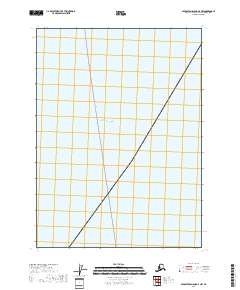
2018 Map of Middleton Island D-2 NW
USGS Topo · Published 2018About this map
The Gulf of Alaska dominates this maritime survey, illustrating the open water south of the Alaskan coastline. This 2018 edition provides a precise view of the navigation and administrative boundaries within the Gulf, centered on a section of the Ferry Route that traverses the open sea. The map primarily documents the vast expanse of the northern Pacific, including the Public Land Survey System boundaries for t22s r5e and t23s r5e. While devoid of terrestrial features or settlements, the map serves as a vital record of the marine corridors and maritime surveying zones used for regional navigation and resource management.
Find a feature on this map
4 named features on this map. Tap any name to fly to it.
Don’t see what you’re looking for? This feature index may not catch every label — zoom into the map to look around manually.
Map Details
Editions of this 2018 Middleton Island D-2 NW Map
This is the sole edition of this map. No revisions or reprints were ever made.
Other maps of this area

1948 · Cordova
USGS Topo · 1:250,000

1948 · Middleton Island
USGS Topo · 1:250,000

1950 · Middleton Island
USGS Topo · 1:250,000

1950 · Cordova A-2
USGS Topo · 1:63,360

1951 · Cordova
USGS Topo · 1:250,000

1953 · Cordova A-2
USGS Topo · 1:63,360
1955 · Middleton Island D-1 and D-2
USGS Topo · 1:63,360
1955 · Middleton Island
USGS Topo · 1:250,000

1959 · Cordova
USGS Topo · 1:250,000
1965 · Middleton Island
USGS Topo · 1:250,000