
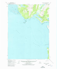
1950 Map of Cordova A-2
USGS Topo · Published 1964About this map
Katalla and its surrounding coastal landscape sit at a transition point of industrial history within the Chugach National Forest. The map documents the early extractive economy of the region, specifically marking the Katalla Oil Field and an abandoned Refinery near the mouth of the Katalla River. This industrial footprint is further evidenced by an Old Railroad Grade that winds through the foothills of Ragged Mountain, once connecting the shoreline to interior resources.
Find a feature on this map
35 named features on this map. Tap any name to fly to it.
Don’t see what you’re looking for? This feature index may not catch every label — zoom into the map to look around manually.
Map Details
Editions of this 1950 Cordova A-2 Map
4 editions found
Other maps of this area

1948 · Cordova
USGS Topo · 1:250,000

1948 · Middleton Island
USGS Topo · 1:250,000

1950 · Middleton Island
USGS Topo · 1:250,000

1950 · Cordova B-2
USGS Topo · 1:63,360

1950 · Cordova A-1
USGS Topo · 1:63,360

1951 · Cordova
USGS Topo · 1:250,000

1951 · Cordova B-1
USGS Topo · 1:63,360

1952 · Cordova B-3
USGS Topo · 1:63,360

1953 · Cordova A-2
USGS Topo · 1:63,360

1953 · Cordova B-1
USGS Topo · 1:63,360